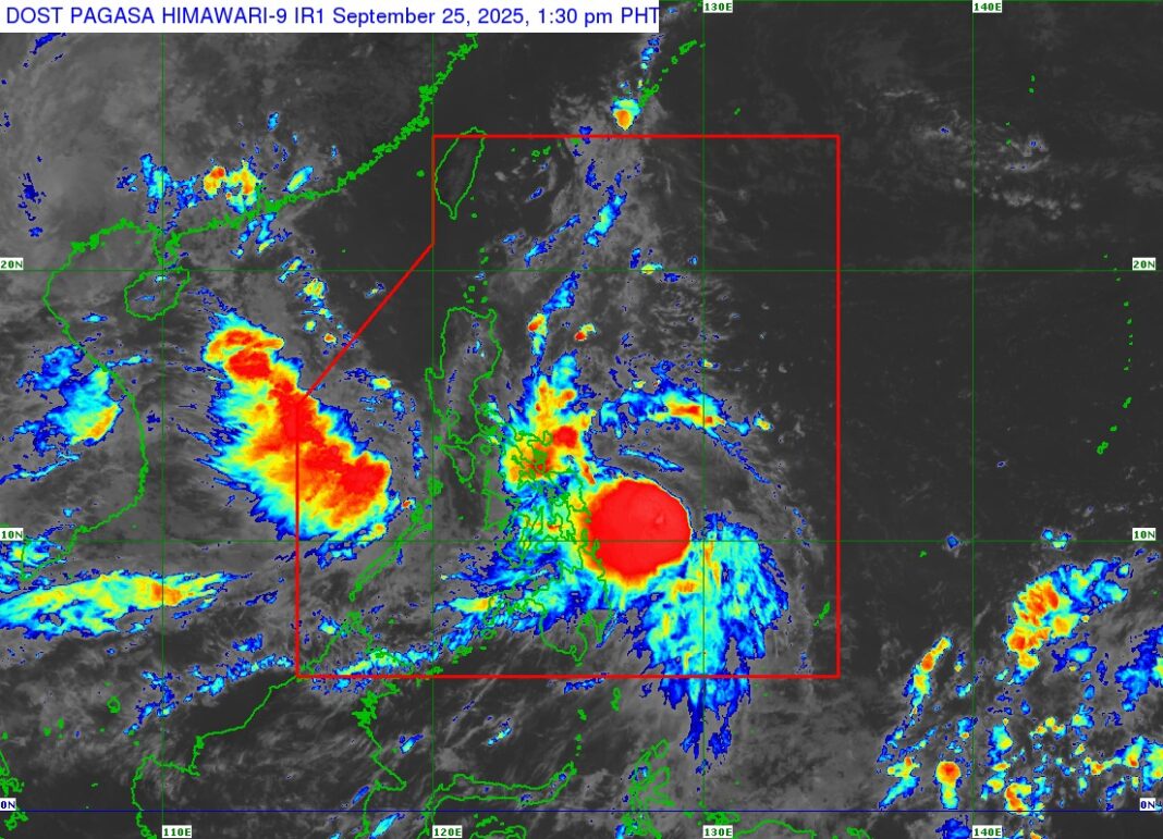
THE Philippine Atmospheric, Geophysical and Astronomical Services Administration (PAGASA) reports that Severe Tropical Storm (STS) Opong continues to maintain its strength while moving westward across the Philippine Sea.
Location and Movement
- As of 1:00 PM, the center of Severe Tropical Storm Opong was located 300 kilometers east of Guiuan, Eastern Samar (11.0°N, 128.5°E), based on available data including observations from the Guiuan Doppler Weather Radar.
- Movement: Westward at 15 km/h
Intensity
- Maximum sustained winds: 110 km/h near the center
- Gustiness: Up to 135 km/h
- Central pressure: 980 hPa
- Extent of tropical cyclone winds: Strong to storm-force winds extending outward up to 430 km from the center
Tropical Cyclone Wind Signals (TCWS) in Effect
TCWS No. 3
- Wind Threat: Storm-force winds
- Warning Lead Time: 18 hours
- Wind Speed Range: 89 to 117 km/h (Beaufort Scale 10–11)
- Potential Impact: Moderate to significant threat to life and property
Areas under TCWS No. 3 (Visayas):
- Northern and eastern portions of Northern Samar: Gamay, Lapinig, Mapanas, Palapag, Laoang, San Roque, Pambujan, Catubig
- Northern portion of Eastern Samar: San Policarpo, Arteche, Jipapad, Oras
TCWS No. 2
- Wind Threat: Gale-force winds
- Warning Lead Time: 24 hours
- Wind Speed Range: 62 to 88 km/h (Beaufort Scale 8–9)
- Potential Impact: Minor to moderate threat to life and property
Areas under TCWS No. 2:
Luzon:
- Southern portion of Quezon
- Eastern portion of Marinduque
- Northeastern Romblon
- Camarines Norte, Camarines Sur, Catanduanes, Albay, Sorsogon, Masbate
Visayas:
- Remaining areas of Northern Samar
- Central portion of Eastern Samar
- Northern and central Samar
- Biliran
- Northern portion of Leyte
TCWS No. 1
- Wind Threat: Strong winds
- Warning Lead Time: 36 hours
- Wind Speed Range: 39 to 61 km/h (Beaufort Scale 6–7)
- Potential Impact: Minimal to minor threat to life and property
Luzon:
- Central and southern Isabela
- Quirino, Nueva Vizcaya, Ifugao, parts of Mountain Province, Benguet, Ilocos Sur, La Union, Pangasinan, Aurora, Nueva Ecija, Tarlac, Zambales, Bataan, Pampanga, Bulacan, Metro Manila, Rizal, Cavite, Batangas, Laguna, remaining areas of Quezon, Romblon, Marinduque, Occidental Mindoro, Oriental Mindoro, Calamian Islands
Visayas:
- Remaining areas of Eastern Samar, Samar, Leyte, Southern Leyte
- Northern portion of Cebu (including Camotes and Bantayan Islands)
- Northern Negros Occidental
- Northern Iloilo, Capiz, Aklan, northern Antique
Mindanao:
- Siargao Island, Bucas Grande Islands, Dinagat Islands
Other Hazards Affecting Land Areas
Heavy Rainfall Outlook
Residents are advised to refer to Weather Advisory No. 24, issued at 11:00 AM today, for details on heavy rainfall forecasts associated with Severe Tropical Storm Opong and the southwest monsoon.
Advisory to the Public
PAGASA reminds the public and concerned disaster risk reduction and management offices to monitor updates, take precautionary measures, and heed warnings from local authorities, especially in areas under Wind Signal No. 2 and 3. Risk of flooding, landslides, and coastal hazards remains, especially in low-lying and mountainous areas.
The next weather bulletin will be issued as scheduled or as necessary.
SOURCE: DOST-PAGASA
#OpongPH #WeatherAlert #PAGASABulletin #StormWatch


